Welcome to the Mulberry Fields Travel Plan Site. We’re here to help you utilise the best of your area, be that shops, facilities or public transport.
This page is designed for you! Think of this page as your one stop shop for all the latest, up to date information regarding travel and your local area. On this page you can find information on:
Your local area (inc. map)
Local pedestrian network
Local cycle network
Travel by bus – routes and service information
Travel by rail – station facilities, ticket and service information
Car Travel options
Free Travel Gift
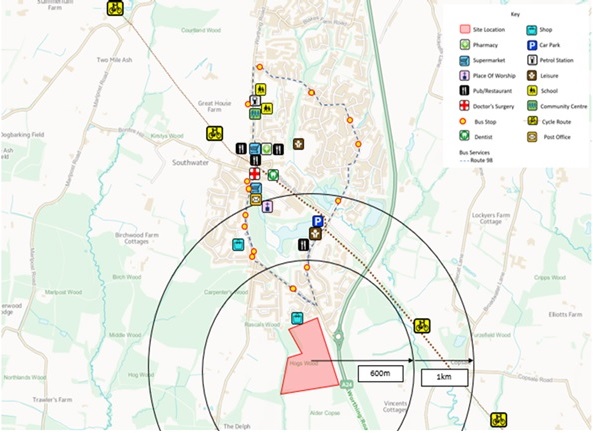
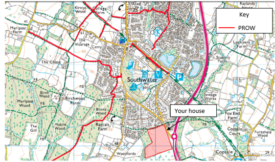
Southwater Town Centre is located approximately 1km (15 minute walk/ 4 minute cycle) north of your home and comprises a variety of amenities such as a supermarket, restaurants, doctor’s surgery, post office, dentist and a pharmacy.
The accessibility map below highlights all of the major amenities and points of interest that can be found in the vicinity of your new house.
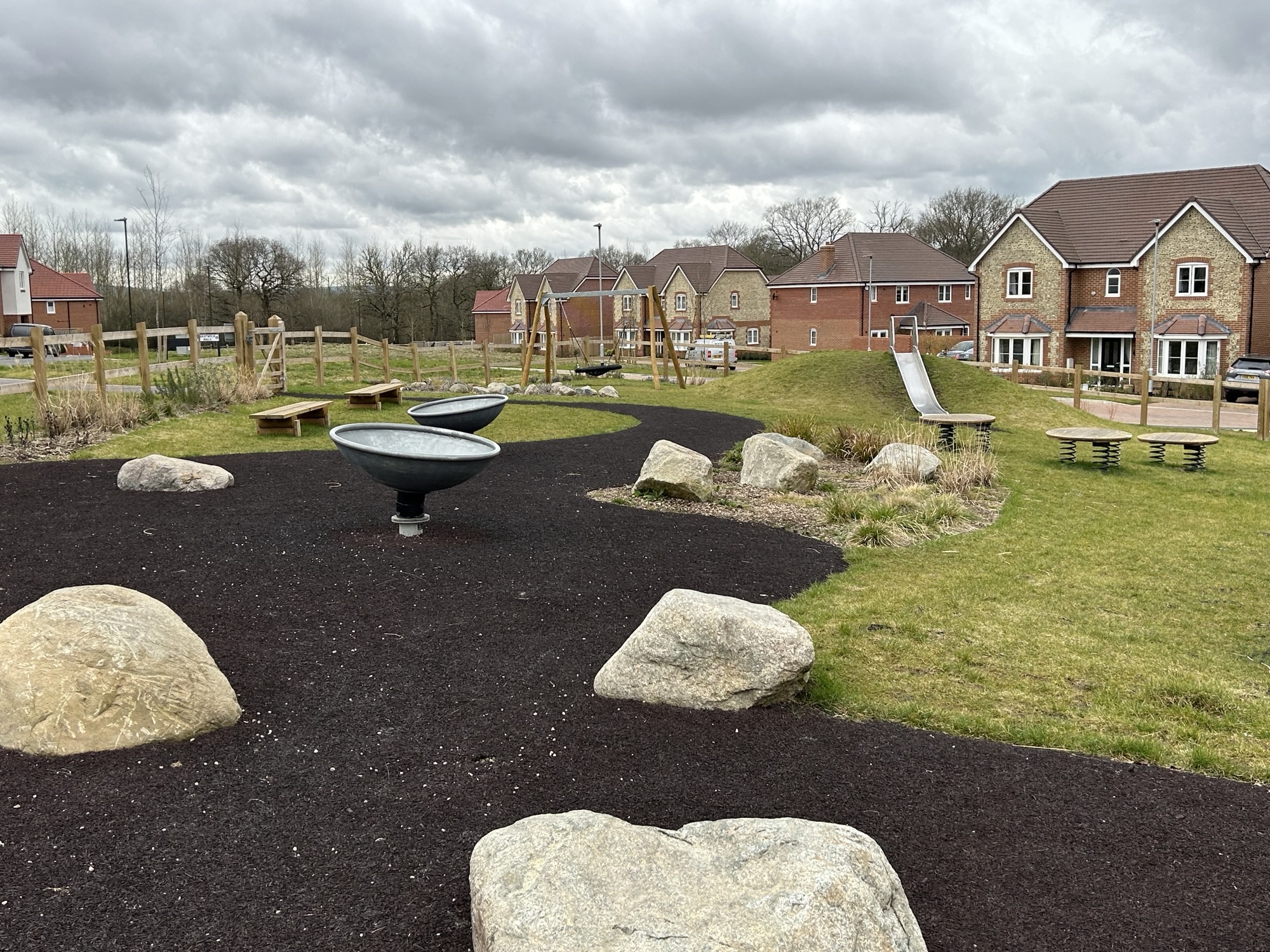
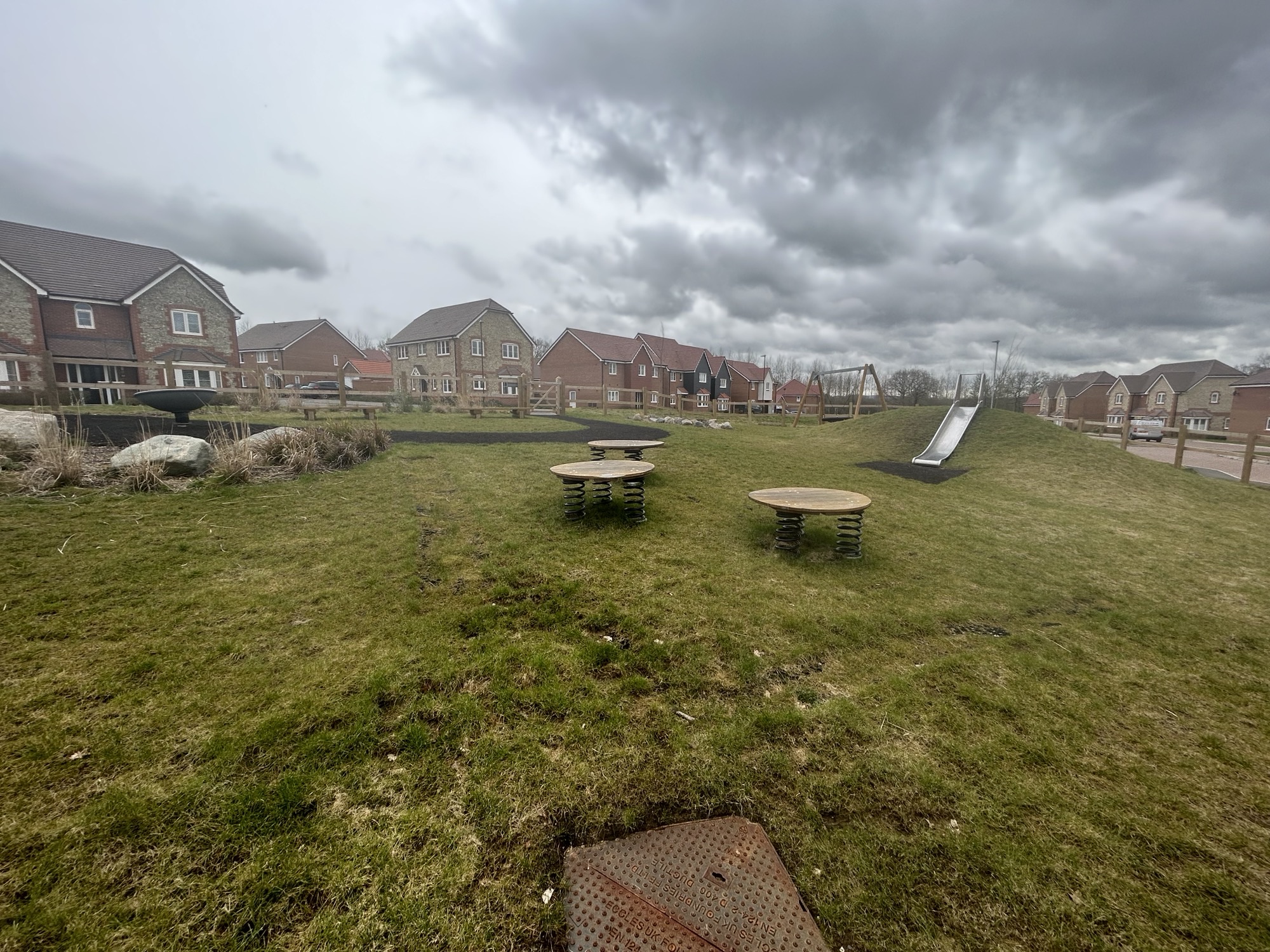
Your home also has its own playground on site, which will be perfect as the weather improves !
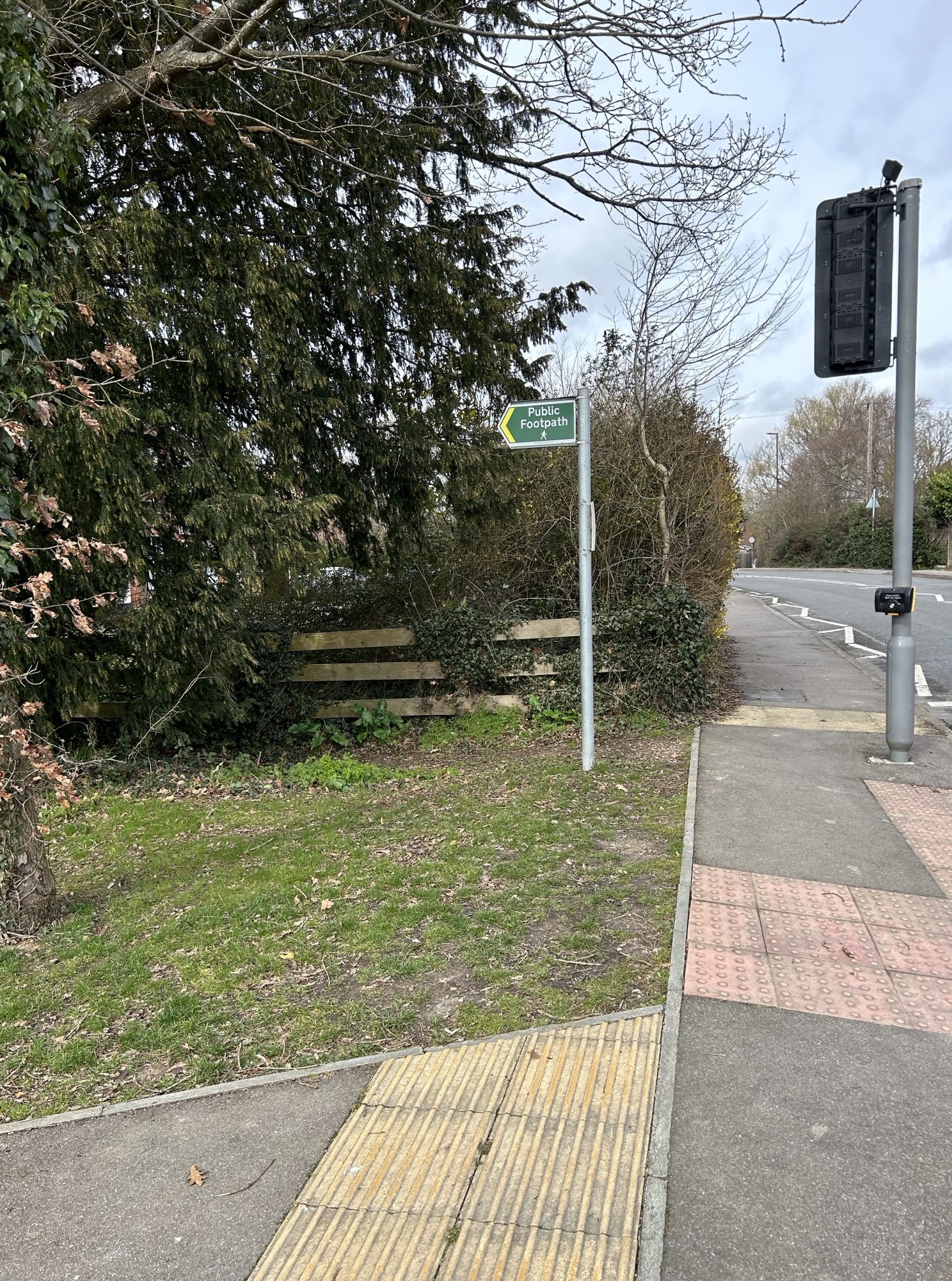
Local Pedestrian Network
Benefits of walking
Its free.
Increasing your cardiovascular fitness
Lowering anxiety and stress
Boosting your energy and improving your mood
Strengthening your bones, improving your balance and boosting your muscle power
With plenty of open fields and Southwater Country Park on your doorstep provides the perfect opportunity to put on your walking boots and get outside.
Local Cycle Network
The Benefits of Cycling!
It saves you money
It’s an easy way to build physical activity into your daily routine
It’s good for your mental health
Cycling can play a huge part in tackling air pollution
Fresh air, freedom and fun
Why not switch 4 wheels to 2 and get on your bike; for exercise or just for fun. For ideas of local cycle routes, Horsham District Council have devised a list highlighting all the best cycling routes in your local area. To find out more visit: https://www.horsham.gov.uk/sport-and-leisure/cycling.
In addition, the helpful map found on Sustrans shows the National Cycle Routes (NCR) in the surrounding area. NCR 223 connects to numerous destinations in the surrounding area including Christ’s Hospital, Slinfold, West Grinstead and many more.
Local Cycle Routes
With so many great cycling routes on your doorstep, why not put your £150 towards a cycle voucher for a bran new bike visit: https://www.halfords.com/
The town of Horsham is a 24 minute cycle/ 15 minute bus away and provides a more comprehensive range of amenities.
Travel By Bus
Why take the bus?
The walk to and from the bus is a great way to incorporate some physical activity into your daily routine
Relax and read a book whilst you travel to your destination
Season tickets offer unlimited travel on services and can prove cheaper than running a car
As the local bus network offers a comprehensive range of routes and destinations, and with an 8 week Metrovoyager bus voucher available, this could this be the travel mode for you?
The table below demonstrates the most frequent local bus services available near you. The full bus timetables for metrobus is available here: https://www.metrobus.co.uk/services. Just search for the 23 or 98 service to see their full weekly schedule, with a summary provided below.
Service 23Crawley-Horsham-Worthing– Every hour (Monday-Saturday), every two hours (Sunday)
Service 98 Southwater-Littlehaven– Every 15-20 minutes (Monday-Saturday)
Cripplegate Corner bus stop is your closest stop (300m/ 4 minute walk from the site), this stop has a number of services running from it, and operates in both northbound and southbound directions. The services from this stop are run by Metrobus and Sussex Coaches (https://bustimes.org/operators/sussex-coaches), and include the 23. 98, 398, 626 and 621 services. Full up to date timetables can be found on their websites.
Travel By Rail
Christ Hospital Railway Station is located c.3.7km from your home and is easily accessible via a 15 minute cycle.
Why take the train?
Taking the train means you can work on the go or relax, without the stress of driving and parking.
It’s good for the planet; trainline will show you how much C02 you saved based on your journeys!
It can be faster than travelling by road.
With services from this station running hourly, the train is the perfect way to travel to work or a weekend trip to London! For detailed and up to date train journey information for Christs Hospital Station visit: https://www.nationalrail.co.uk/stations/christs-hospital/.
Horsham Railway Station is located c.7.5km from your home and is easily accessible via a the 98 bus from Cripplegate Corner bus stop, 300m/ 4 minute walk away. Bus journeys to Horsham Railway Station take approximately 25 minutes and come at a frequency of between every 15-20 minutes.
The bus is the best way to access Horsham Railway Station, avoiding the stress of traffic, finding a place to park and expensive parking fees.
Car Travel Options
Car Sharing
Save money by sharing costs with other people – a commuter can typically save around £1,000 a year by car-sharing. Reduce stress and cut your carbon footprint at the same time.
To find useful links visit our useful sites page which has information for all sustainable transport modes!
Your Free Travel Gift
Each address is entitled to claim one voucher for either bus or cycle use, if no previous resident at the address has claimed. Select from:
£150 Halfords Voucher*
£150 Metrovoyager bus pass**
If a claim has already been received for your address you will not be eligible to claim again. To confirm whether you are eligible for the travel voucher offer please email us at: travelplan@paulbashamassociates.com. You can also contact us at this email address if you have any further questions about the offer(s).
Terms & Conditions:
Sustainable Travel Vouchers are a gift from Miller Homes and the offer(s) may be amended or removed at any time.
One claim per address can be made. If a claim has already been received for your address you will not be eligible to claim again. Please contact us to confirm your eligibility at travelplan@paulbashamassociates.com.
*Halford voucher is £150 and only redeemable for purchases associated with cycling. Their terms and conditions are outlined on the voucher, which will be sent via post.
**Metrovoyager offer is for adult tickets only. Tickets up to the value of £150. The type of ticket is dictated by Metrovoyager and may vary over time.The voucher is likely to be in the form of an emailed code(s) and details of how to activate the code will be provided to any claimant.
We are unable to offer exchanges or reissues for vouchers. Please also be aware of any expiry dates.
In order to process your request your details could be passed onto third parties for the purpose of claiming your voucher. If you have any queries about your data, you can email travelplan@paulbashamassociates.com to obtain our current policy.