

Hello Westvale Park resident! Welcome to your Travel Plan page.
Here at Paul Basham Associates we are your ‘Travel Plan Coordinators’ which means that we are here to help you make informed travel choices and provide advice on your local area and the surrounding travel opportunities.
This page intends to keep residents up to date on local information such as:
- Local Area
- Travel Voucher
- Walking
- Cycling
- Bus
- Rail
- Car Travel
Much of the information is provided through direct links to other websites, ensuring that the information we provide, and you use, is up to date. Visit the ‘useful sites‘ page for links to local operators, cycle and walking schemes and more. This information is correct as of February 2026.
Local area
Your home is in proximity to numerous facilities located within Horley. We have provided a handy map below which gives an indication as to where you may find certain facilities.

Horley is only a 6 minute cycle ride (or a 25 minute walk) away. Here you’ll find a selection of facilities including a post office, restaurants, pubs, supermarkets and independent and national retail chains among many others. Click here for a more detailed list of facilities and where to find them.
Travel voucher
You may be eligible to claim a free 4-week adult Metrovoyager ticket* Please visit www.metrobus.co.uk/westvale to apply.
The ticket is valid for 4-weeks from the date of activation and on all Metrobus services operating around Westvale Park, including services operated by Brighton & Hove Buses.
*Sustainable Travel Vouchers are a gift and the offer may be amended or removed at any time.
One FREE Adult 4 Week Metrovoyager ticket issued per household (once per address).
Valid for travel on all Metrobus services as well as services operated by Brighton & Hove Buses.
The ticket is non-transferable and non-refundable.
This is a continuation of the previous offer that was available on Southdowns buses. If you or someone at your address has already claimed this previously you will not be eligible.
The type of ticket is dictated by Metrobus and may vary over time. The voucher will be in the form of an emailed code(s) and the user will need to download the Metrobus app to access the ticket(s).
Further information can be found at www.metrobus.co.uk/westvale
Your data will be processed by Paul Basham Associates who operate at the Travel Plan Coordinators for the Westvale Park development. You may therefore receive an email from travelplan@paulbashamassociates.com if any of your details are unclear.
Once your request has been passed to Metrobus only the first line of your address will be kept on file by Paul Basham Associates.
Your data will be managed in accordance with both Paul Basham Associates and Metrobus Data Protection policies and will not be shared with any other third parties. If you would like a copy of these policies please contact Paul Basham Associates as the email address above.
Walking
Horley is easy to explore on foot!
Benefits to walking include:
- Increasing your cardiovascular fitness
- Lowering anxiety and stress
- Boosting your energy and improving your mood
- Strengthening your bones, improving your balance and boosting your muscle power
East Surrey Walkers Group
The East Surrey Walkers Group are an active and friendly group who aim to enjoy their local area on foot. Walks are available multiple times a week and people of all ages and abilities are welcome to try walking with the group.
To find out more, visit: https://www.ramblers.org.uk/go-walking/ramblers-groups/east-surrey-walkers-group
Surrey BetterPoints
Surrey County Council are running an amazing programme that allows you to earn rewards and win prizes by travelling sustainably.
Simply download the app, register and turn on autotracking and start travelling sustainably! You will gain points for walking, wheeling or travelling via public transport, which you can put towards vouchers or charity donations.
To get started, download the BetterPoints app from the app store or visit: www.surrey.betterpoints.app
Cycling
Benefits of Cycling:
- Decreases your stress levels
- Improves posture and coordination
- Strengthens bones and improves joint mobility
- Reduces congestion
- Saves you money
- Increased cardiovascular fitness
If you fancy getting out on your bike, cycle routes in the area make your trip an easy way to travel. The map below shows cycle routes within your area.
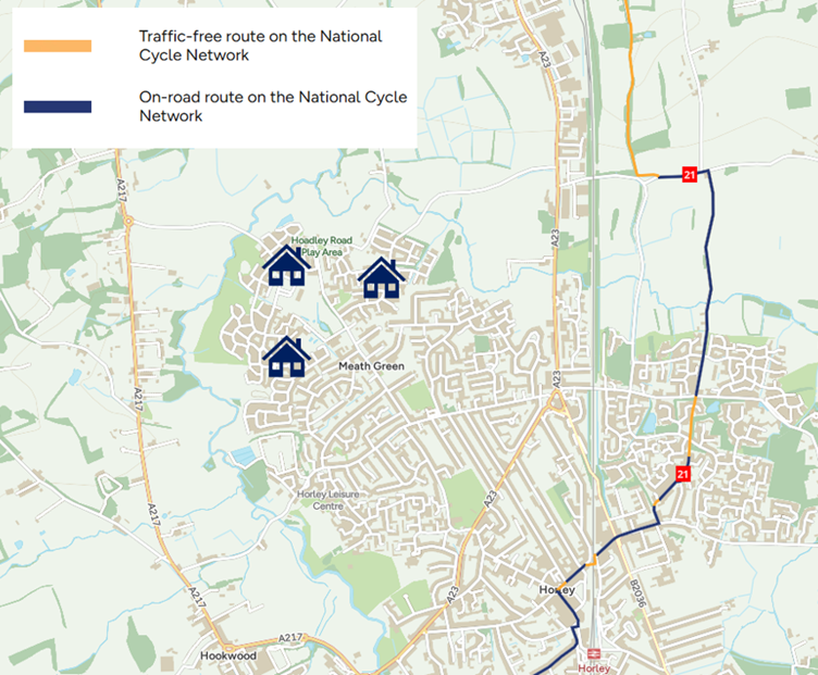
Horley Cycle Routes
In addition, Riverside Green Park is located an approximate 11-minute cycle to the south of the site. The park forms part of the Horley Green Chain which is a belt of public open space providing a key commuter route between Horley and Gatwick Airport as well as a recreational and leisure facility for all to enjoy.
Why not take the children for a bike ride and enjoy a picnic in the park?
Alternatively, if you want to find cycle routes in any given area, the Walk Wheel Cycle Trust has provided an interactive map, where you can plan your journey.
To find out more, visit: https://explore.osmaps.com/?overlays=os-ncn-layer
Bus
There are a range of bus services near to your home in Westvale Park.
Metrobus routes 100 and 424 serve Westvale Park 7 days a week:
- ‘Fastway’ Route 100: This is a 24 hour bus service operating 7 days a week through Westvale Park, serving all stops on Webber Street and Hoadley Road. Route 100 operates to Salfords, East Surrey Hospital, Redhill, Gatwick Airport, Crawley, Three Bridges and Maidenbower. More information can be found here: www.metrobus.co.uk/services/MB/100
- Route 424: This service operates 7 days week through Westvale Park serving all stops on Webber Street and Hoadley Road. On Mondays to Saturdays, route 424 operates to Sidlow, Woodhatch, Reigate, Timperley Gardens, Redhill, St Bede’s School, Horley, Smallfield, Copthorne and Crawley. On Sundays/Public Holidays, the route operates to Sidlow, Woodhatch, Reigate, Redhill, Horley, Smallfield and Copthorne only. More information can be found here: www.metrobus.co.uk/services/MB/424
| Route | Operator | Destinations | Days of Operation | Nearest Stops | More Info |
| 22 | Metrobus | Horley, Gatwick Airport, Manor Royal, Crawley, Tesco Hookwood, Charlwood, Leigh, Dorking, Westcott, Abinger Hammer | Monday to Friday | Lee Street, Vicarage Lane | www.metrobus.co.uk/services/MB/22 |
| 26 | Compass | Horley town area, Hookwood Tesco | Mon, Wed, Fri (4 trips/day) | Greenfields Road, Landen Park, Westleas, Witherdale, Court Lodge Rd | www.compass-travel.co.uk/bus-timetables/ |
| 324 | Metrobus | St Bede’s School, Reigate College | School days only (2 trips/day) | Lee Street, Horley Row | www.metrobus.co.uk/services/MB/324 |
| 400 | Metrobus | Salfords, East Surrey Hospital, Redhill, Nutfield, Bletchingley, Godstone, Caterham, Gatwick Airport, Crawley, Three Bridges, Copthorne, East Grinstead | 7 days a week | A23 | www.metrobus.co.uk/services/MB/400 |
| 420 | Metrobus | Salfords, East Surrey Hospital, Redhill, Reigate, Tadworth, Banstead, Sutton, Gatwick Airport, Crawley | 7 days a week | A23 | www.metrobus.co.uk/services/MB/420 |
| 460 | Metrobus | Salfords, East Surrey Hospital, Redhill, Reigate, Tadworth, Epsom, Gatwick Airport, Crawley | 7 days a week | A23 | www.metrobus.co.uk/services/MB/460 |
Other bus services operating near to Westvale Park
For the most up to date bus information visit Metrobus: www.metrobus.co.uk/ and Surrey County Council: www.surreycc.gov.uk/roads-and-transport/buses-and-other-transport
Rail
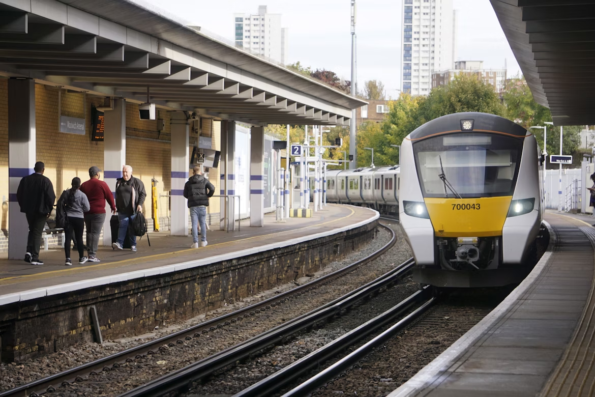
Your nearest railway station is Horley (HOR) Railway Station located around 3km from your home. The station is well equipped to suit your every need, with 76 cycle storage spaces, 94 car parking spaces, customer help points and CCTV.
Horley Railway Station is served by Thameslink and Southern services, with regular weekday and weekend services to lots of stations including London Victoria, London St Pancras, Gatwick Airport, East Croydon and Horsham.
View live departures at www.nationalrail.co.uk/live-trains/departures/horley/
Getting to the station
It takes approximately 30 minutes to walk or 9 minutes to cycle to Horley station from your home in Westvale Park.
You can also access the railway station via bus. Service 424 stops outside the station, or you can get service 100 to Horley Town Centre, with the station being a short walk from there. Service 100 also links to Gatwick Airport South Terminal, where you can access Gatwick Airport Station via the lifts.
Please check before you travel by visiting the National Rail website for information.
Car Travel
We understand that sometimes driving is the only option. Therefore, using sustainable driving practices such as car sharing can help save you money and reduce your impact on the environment!
Why not give lift-sharing a go? The Liftshare app and website allows you to find drivers or passengers to share your journey, which helps you to save money, reduce congestion and meet new people.
Find out more at: https://liftshare.com/uk
With the move towards hybrid and electric vehicles in the coming years, now is the time to make the switch and go electric!
Electric vehicles are more affordable than you may think, and offer amazing benefits such as:
- Lower / no fuel costs
- Lower / no emissions tax
- Lower maintenance costs
- Eco-friendly with minimal emissions
Zapmap is a useful website that provides information on public charging points. Find out more at: www.zap-map.com/
